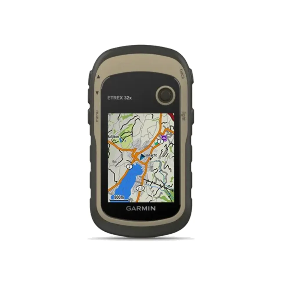
Rugged Handheld GPS with Compass and Barometric Altimeter. eTrex 32x offer the same ease of use, durability and affordability that the eTrex handheld GPS series is known for — along with preloaded TopoActive maps. These devices are perfect for quad bikes, bicycles, boats or hiking.
Features:
- 2.2” sunlight-readable colour display with 240 x 320 display pixels for improved readability
- Preloaded with TopoActive maps with routable roads and trails for cycling and hiking
- Support for GPS and GLONASS satellite systems allows for tracking in more challenging environments than GPS alone
- 8 GB of internal memory for map downloads plus a microSD™ card slot
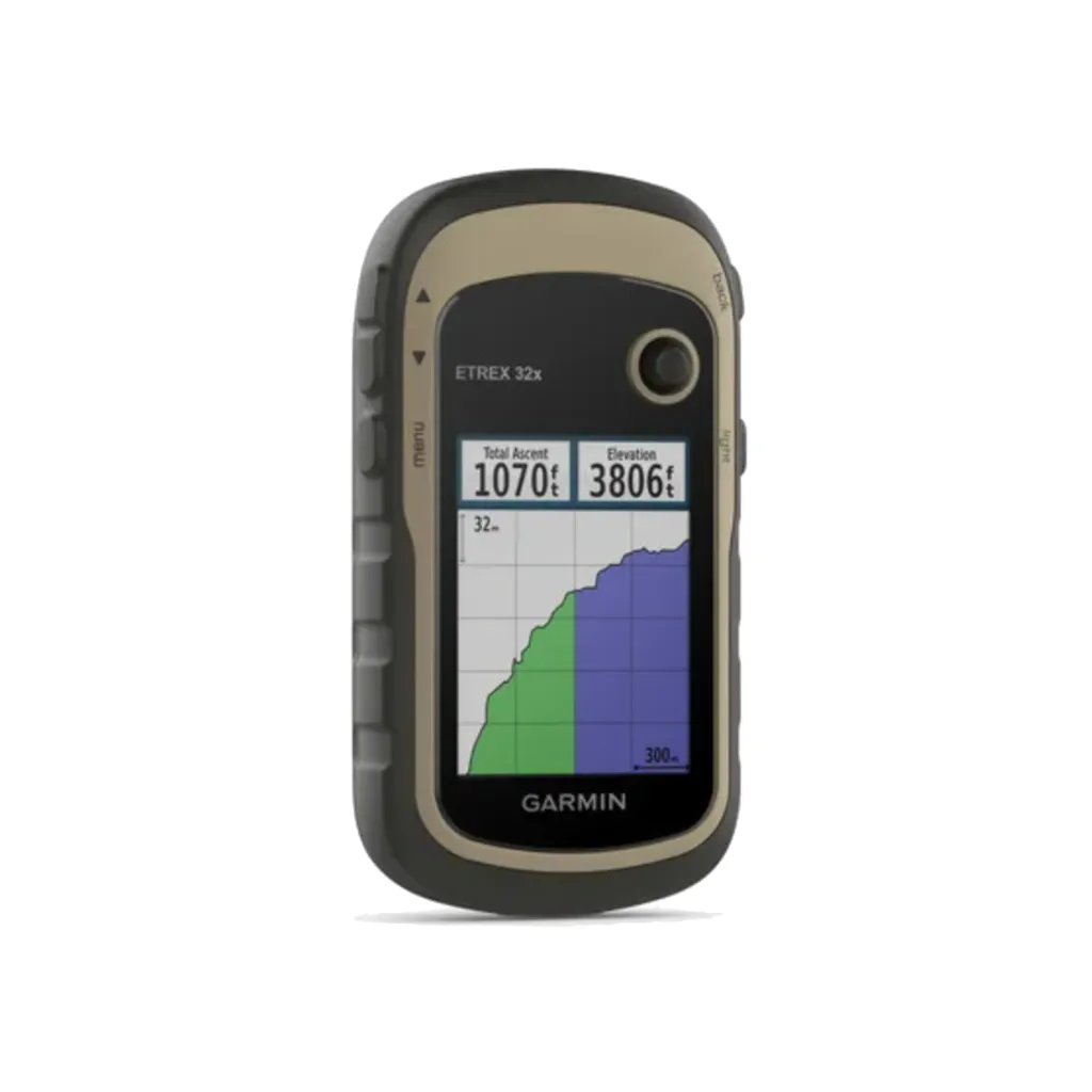
- eTrex 32x adds a 3-axis compass and barometric altimeter
- Battery life: up to 25 hours in GPS mode with 2 AA batteries
- Add maps: with a microSD card slot and expanded 8 GB of internal memory, you can easily download additional maps for wherever the adventure takes you
- Paperless : upload GPX files straight to your device, and view key information such as location, terrain and hints from
- Go anywhere: with an array of compatible mounts, eTrex is designed as an outdoor handheld GPS ideal for use on quad bikes or bicycles, in boats or on foot
- In the Box:
- eTrex 32x
- USB cable
- Documentation
General:
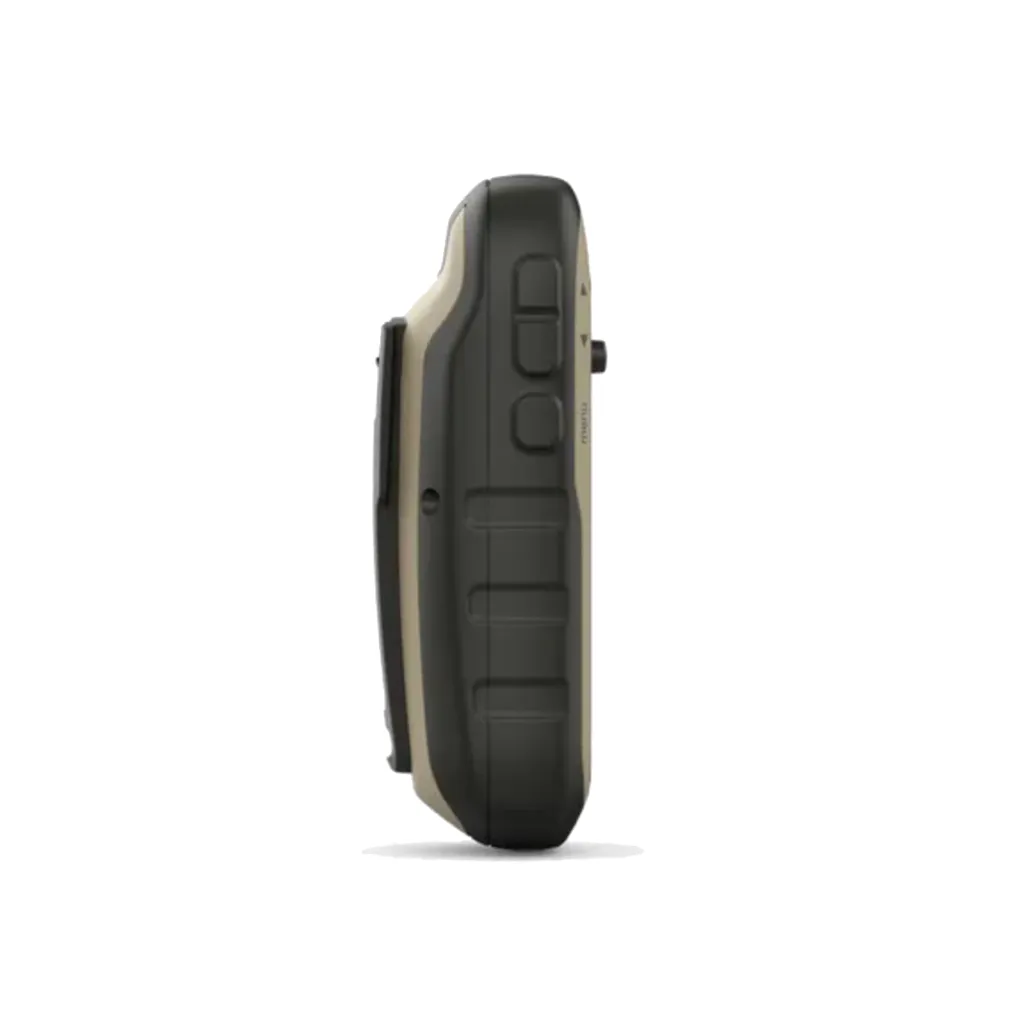
| Dimensions | 5.4 x 10.3 x 3.3 cm |
| Weight | 141.7 g (with batteries) |
| IPX7 | |
| Display Type | 2.2" transflective, 65K colour TFT |
| Display Size | 3.5 x 4.4 cm; 2.2" diag (5.6 cm) |
| Display Resolution | 240 x 320 pixels |
| Battery Type | 2 AA batteries (not included); NiMH or Lithium recommended |
| Battery Life | 25 hours |
| Memory/History | 8GB |
| Interface | mini USB |
Maps & Memory:
| Preloaded Maps | yes (TopoActive; routable) |
| Ability to Add Maps | yes |
| Basemaps | yes |
| Automatic Routing (Turn by Turn Routing on Roads) for outdoor activities | yes |
| Map Segments | 3000 |
| Includes detailed Hydrographic features (Coastlines, Lake/River Shorelines, Wetlands and Perennial and Seasonal Streams) | yes |
| Includes Searchable Points of Interests (Parks, Campgrounds, Scenic Lookouts and Picnic Sites) | yes |
| Displays National, State and Local Parks, Forests, and Wilderness Areas | yes |
| External Memory Storage | microSD™ card (not included) |
| Waypoints/Favourites/Locations | 2000 |
| Tracks | 200 |
| Navigation Track Log | 10,000 points, 200 saved tracks |
| Navigation Routes | 200 |
Sensors:
| GPS | yes |
| GLONASS | yes |
| Barometric Altimeter | yes |
| Compass | Yes (tilt-compensated 3-axis) |
| High-Sensitivity Receiver | yes |
Daily Smart Features:
| VIRB® Remote | yes |
Outdoor Recreation:
| Point-to-Point Navigation | yes |
| Area Calculation | yes |
| Hunt/Fish Calendar | yes |
| Sun and Moon Information | yes |
| Yes (Paperless) | |
| yes (100 custom map tiles) | |
| Picture Viewer | yes |
Connections:
| Wireless Connectivity | yes (ANT ®) |


")


